Unravel the rich history and cultural heritage of Lae, Papua New Guinea, through its captivating historical sites. Embark on a journey to the past as you explore these significant landmarks and delve into the stories they hold. Discover the essence of Lae’s history, culture, and heritage through these iconic sites that stand as testaments to the region’s remarkable past.
Immerse yourself in the legacy of Lae by visiting the Papua New Guinea University of Technology, the Lae War Cemetery, the Lae Botanical Gardens, and the Huon Peninsula. These historical sites offer a glimpse into the region’s colonial past, wartime struggles, and the natural beauty that has captivated visitors for centuries. Get ready to be captivated by the historical significance and beauty of these must-visit destinations.
Top Historical Site in Lae, Papua New Guinea

Top Historical Site in Lae, Papua New Guinea
Amelia Earhart Memorial
- Address: 7X9X+H9H, Lae Morobe Province, Papua New Guinea
- Map: Click here
- Rating: 3.1 (42)
- Opening hours:
Monday: Open 24 hoursTuesday: Open 24 hoursWednesday: Open 24 hoursThursday: Open 24 hoursFriday: ClosedSaturday: Open 24 hoursSunday: Open 24 hours
[mbag-comment]
Embark on a thrilling journey through the diverse array of Historical Site in cities like Port Moresby, Nouméa and Rotorua across the Oceania continents, revealing hidden gems waiting to be discovered. Whether you’re a local business or a multinational company, these cities proudly display a rich tapestry of profesional services designed to cater to a wide array of preferences.
The 4 Best Historical Site near Lae, Papua New Guinea

World War 2 Plane Wreckage
- Address: 7XHV+3J7, Lae Morobe Province, Papua New Guinea
- Map: Click here
- Rating: 4.2 (20)
- Opening hours:
Monday: Open 24 hoursTuesday: Open 24 hoursWednesday: Open 24 hoursThursday: Open 24 hoursFriday: Open 24 hoursSaturday: Open 24 hoursSunday: Open 24 hours - Reviews:
2 years agoOk so I’ll just give the plane specs. The Douglas DC-3 is a fixed wing piston engine plane with a range of 2,400 km, a wingspan of 29 m and a cruising speed of 241 km/h.2 months agoIt looks nice through the fence, but to be honest, I don’t exactly know how to get in.6 years agoThere is an Australian dc3 in the botanical gardens. It was taxed off the old runway and parked in the gardens. Trees have grown over the years to disguise how it got there Worth a look as you drive past4 years agoThe plane wreckage is located within the Lae most beautiful botanical garden. A nice place to visit for picnic and study purposes.4 years agoBeautiful Botanical Garden in the middle of the City
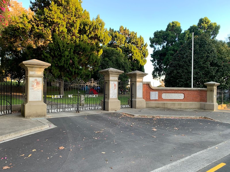
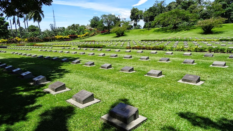
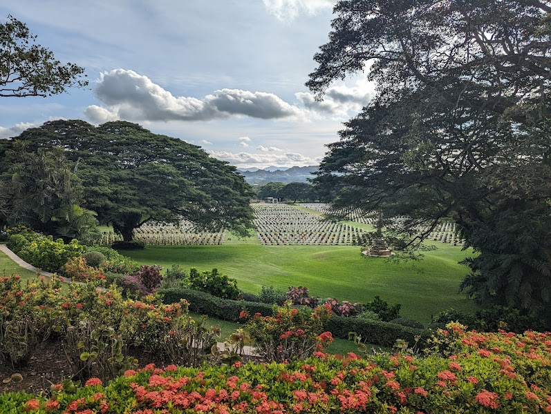
Lae War Cemetery
- Address: 7XHW+2M9, Lae Morobe Province, Papua New Guinea
- Map: Click here
- Rating: 4.3 (18)
Zamu
- Address: 7XMX+QXJ, Lae Morobe Province, Papua New Guinea
- Map: Click here
- Rating:
Thank you for reading! If you have any additional information on the best Historical Site in Lae, Papua New Guinea, please leave a comment above. We would love to hear from you!
![Nouméa (French pronunciation: [numea]) is the capital and largest city of the French special collectivity of New Caledonia and is also the largest francophone city in Oceania. It is situated on a peninsula in the south of New Caledonia's main island, Grande Terre, and is home to the majority of the island's European, Polynesian (Wallisians, Futunians, Tahitians), Indonesian, and Vietnamese populations, as well as many Melanesians, Ni-Vanuatu and Kanaks who work in one of the South Pacific's most industrialised cities. The city lies on a protected deepwater harbour that serves as the chief port for New Caledonia.
At the September 2019 census, there were 182,341 inhabitants in the metropolitan area of Greater Nouméa (French: agglomération du Grand Nouméa), 94,285 of whom lived in the city (commune) of Nouméa proper. 67.2% of the population of New Caledonia live in Greater Nouméa, which covers the communes of Nouméa, Le Mont-Dore, Dumbéa and Païta.](https://upload.wikimedia.org/wikipedia/commons/2/27/View_over_Noumea.jpg)


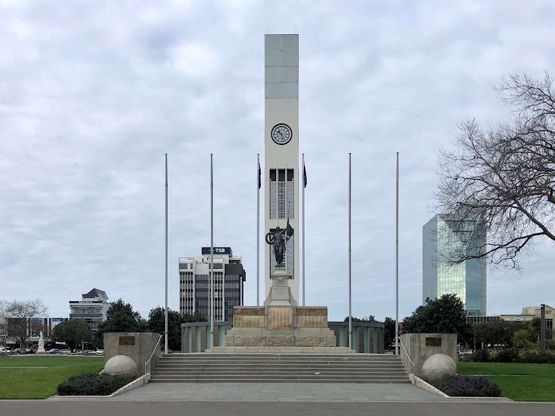
![Whangārei (Māori: [faŋaːˈɾɛi]) is the northernmost city in New Zealand and the regional capital of Northland Region. It is part of the Whangārei District, a local body created in 1989 from the former Whangārei City, Whangārei County and Hikurangi Town councils, to administer both the city proper and its hinterland. The city population was estimated to be 56,900 in June 2023, an increase from 47,000 in 2001.](https://upload.wikimedia.org/wikipedia/commons/6/68/Parihaka_te_Maunga.jpg)
![Tauranga (Māori pronunciation: [ˈtaʉɾaŋa]) is a coastal city in the Bay of Plenty Region and the fifth-most populous city of New Zealand, with an urban population of 161,800 (June 2023), or roughly 3% of the national population. It was settled by Māori late in the 13th century, colonised by Europeans in the early 19th century, and was constituted as a city in 1963.The city lies in the north-western corner of the Bay of Plenty, on the south-eastern edge of Tauranga Harbour. The city extends over an area of 141.91 square kilometres (54.79 sq mi), and encompasses the communities of Bethlehem, on the south-western outskirts of the city; Greerton, on the southern outskirts of the city; Matua, west of the central city overlooking Tauranga Harbour; Maungatapu; Mount Maunganui, located north of the central city across the harbour facing the Bay of Plenty; Otūmoetai; Papamoa, Tauranga's largest suburb, located in the Bay of Plenty; Tauranga City; Tauranga South; and Welcome Bay.
Tauranga is one of New Zealand's main centres for business, international trade, culture, fashion and horticultural science. The Port of Tauranga is New Zealand's largest port in terms of gross export tonnage and efficiency. Tauranga is one of New Zealand's fastest-growing cities, with an 11% increase in population between the 2006 census and the 2013 census, and 19% between the 2013 and 2018 census. Due to its rapid population growth, Tauranga has become New Zealand's fifth-largest city, overtaking Dunedin and the Napier-Hastings urban areas.](https://upload.wikimedia.org/wikipedia/commons/e/e4/Walking_up_Mount_Maunganui_09_%285645002843%29.jpg)